
CSIRO's Northern Rivers Flood Report: Strong Science, But Some Big Questions Remain
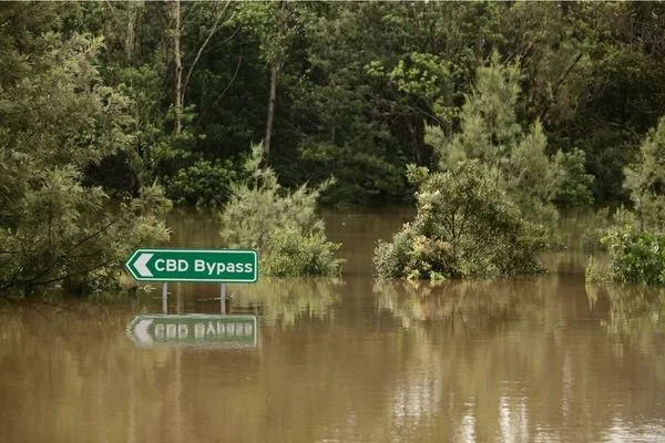
CSIRO's long-awaited final report on flood mitigation options for the Richmond River catchment is out. The engineering modelling behind it is genuinely rigorous – but the same can't be said for how nature-based options and the wider environmental picture were treated, and even the most ambitious option modelled still wouldn't have stopped Lismore's worst flood from breaching the CBD levee.
Here's what that means, and what BES is asking government to address before any shovels go in the ground.
The CSIRO flood report for the NRRI is released
The Ballina Environment Society (BES) has been closely following the release of CSIRO's final report for the Northern Rivers Resilience Initiative (NRRI) – a four-year, $11.4 million project to understand what drives major floods in our region and test whether engineering works could reduce their impact.
The report, released on 30 June 2026, is built on genuinely impressive engineering. CSIRO built the first-ever whole-of-catchment flood model for the Richmond River, using new aerial mapping and underwater river surveys, and tested it against three of our worst floods: 2008, 2017 and the devastating 2022 event. They then modelled two “bundles” of flood mitigation measures – mostly water detention basins upstream of Lismore and Casino, plus upgrades to the Tuckean Swamp, Tuckombil and Boundary Creek – shaped by two rounds of community and council consultation involving almost 700 feedback forms. That modelling work deserves genuine credit. But as we dug into the report, it became clear that this rigour wasn't applied evenly to every option on the table, and some of what's proposed sits uncomfortably with things we already know about our own catchment.
The results are real, but they come with an important caveat. For the smaller and mid-sized events tested (2008 and the March 2022 event), the modelling shows flood peaks at Lismore could be kept below the CBD levee altogether. But for the February 2022 event – the worst flood on record for Lismore – even the larger, more expensive bundle of works only brings the peak down from 14.87m to 12.80m. The Lismore CBD levee sits at 10.65m. In other words, in the very flood that caused the most damage and loss, the levee would still have been breached by more than 2 metres, even with every proposed measure in place. That's a genuinely meaningful reduction in severity – but it is not the same as protecting Lismore from a flood of that scale. We think that distinction matters, and shouldn't get lost in the headline numbers.
So why isn't BES simply celebrating? Because good science answering the question “will this help?” is not the same as answering the much bigger questions: “is this enough, and is it the best use of our money?” And on those questions, the report is refreshingly honest about what it hasn't yet done.
What we think still needs answering
Only past floods were tested, not future ones. The model was run against 2008, 2017 and 2022 – but not against the more intense rainfall that climate science tells us to expect in coming decades. The report itself notes this would be straightforward to add. We think it should be, before a single dollar is spent on construction, so that anything we build isn't already out of date by the time it's finished.
We don't yet know if it's good value. CSIRO is upfront that this report doesn't include a cost-benefit analysis, environmental approvals or detailed design – all of that comes next, in a newly announced $3 million scoping study. We're asking that this analysis be independent and made public before any construction funding is locked in.
Nature-based options haven't had the same scientific attention. Almost 200 of the ~700 community responses raised nature-based ideas – replanting riverbanks, restoring wetlands, reconnecting floodplains – but these were set aside for a separate, still-pending project, while the engineered options went through detailed modelling. We'd like to see nature-based options get the same rigorous testing before final decisions are made.
One of the proposed works may be at odds with what we already know about that site. One of the measures is to keep the Bagotville Barrage at Tuckean Swamp “fully functional” for flood control. But Tuckean Swamp is already well known – including through years of UNSW and OzFish-led research – as one of the worst acid sulfate soil sites in NSW, a legacy of that same barrage excluding tidal flow since 1971, which has caused blackwater pollution and fish kills in the Richmond River for decades. A separate, government-backed restoration project has been working since 2016 towards the opposite fix: reopening the barrage to restore tidal flow. We think the flood report needs to explain how a “keep it fully functional” flood-control measure squares with the restoration work already under way at the same site – not treat them as two unrelated projects.
The habitat impacts of the engineered works themselves haven't been assessed either. The report tells us a lot about water levels and flood extent, but not much about what the detention basins, levees and channel works mean for local wildlife – upstream areas that will be regularly flooded, riparian corridors that could be disrupted, and river ecology affected by changed flow patterns. As an organisation focused on habitat protection, BES thinks this deserves the same rigorous assessment as the flood modelling itself.
Someone has to carry the increased risk upstream. Detention basins work by holding floodwater back – which means more flooding at the storage sites themselves (places like Dunoon, Rock Valley and Corndale) so that downstream towns, including Ballina, get less. That's a reasonable engineering trade-off, but it deserves an honest, costed conversation about fairness to the landholders who carry that burden.
This needs to be communicated honestly, not just in the fine print. Headlines about “reducing flood peaks by 2 metres” are true, but on their own they can leave residents with the impression that the CBD would be protected. It wouldn't be, in a flood on the scale of February 2022. We think any public communication about this project, including future funding announcements, should be explicit that this is about reducing severity and buying response time, not about flood-proofing Lismore.
Managing a whole network of dams in real time is its own risk, separate from the modelling. All of this hydrological modelling assumes the detention basins behave exactly as planned. It doesn't tell us what happens when people have to make split-second decisions about releasing water from ten or more structures at once, during an actual flood, with imperfect forecasts. The clearest warning sign here is the 2011 Brisbane floods: contested decisions about when to release water from the Wivenhoe Dam (a single, actively managed dam) led to a class action and a $440 million compensation payout. The detention basins proposed for our catchment are simpler, more passive structures than Wivenhoe, so it's not a direct comparison – but the same basic risk applies, and it grows with the number of structures involved. We think this deserves a proper answer before this project goes further.
How does this fit with the buybacks already happening? At the same time as this modelling was under way, the NSW Government's Resilient Homes Program has already bought back more than 800 flood-affected homes across the Northern Rivers, with large parts of South and East Lismore permanently taken out of residential use. That's a major, already-funded form of “managed retreat” from the highest-risk floodplain, running alongside plans for new engineered flood defences. We think these two big strategies deserve to be weighed up together, not considered in separate silos.
What BES is doing
We've written to the NSW Minister for the Environment, to our local State MPs, to Ballina Shire Council, and directly to the CSIRO and NEMA project team, raising these points and asking for genuine transparency as the next phase of work gets under way. You can read our full submissions on our website, or get in touch if you'd like a copy.
We want to be clear: BES isn't against flood mitigation infrastructure, and we're not asking anyone to choose between engineering and retreat. Both clearly have a role to play in keeping our communities safe. What we want is for that investment to be tested against the best available climate science, weighed up honestly against its costs, and considered alongside everything else already happening in our catchment – so that when the money is spent, it delivers the protection our region actually needs.
NEMA and CSIRO are returning to the region in July 2026 for community drop-in sessions on the final report. We'd encourage members to attend, ask questions, and have your say – details are available via the NEMA website.
More resources:
CSIRO NRRI project page: https://www.csiro.au/en/research/disasters/floods/Northern-NSW-Resilience-Initiative
Final report (PDF): https://www.csiro.au/-/media/Environment/Northern-Rivers/Flood-mitigation-scenario-analysis-for-the-Richmond-River-catchment.pdf
NEMA – Northern Rivers Resilience Initiative (drop-in session details): http://www.nema.gov.au/our-work/resilience/northern-rivers-resilience-initiative
